Winter Update: Major Chance of a Significant Snowfall
March 3, 2015
Good Tuesday afternoon everyone. I hope that you have all had a great first half of the day. Now after today’s inch or so of snow the main event comes in Wednesday Night-Thursday. Most models are now in agreement that our area will receive significant snowfall.
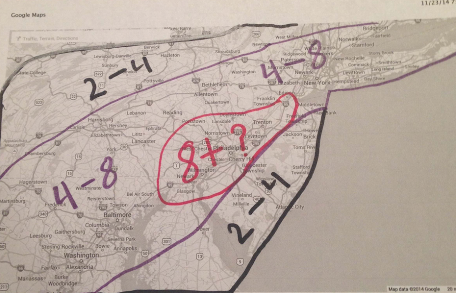
As you can see on my snowfall map below, we are going to be dealing with a good amount of snow. The back section is where I expect 2-4 inches of snow, but locally higher amounts can occur depending on snow bands. In the purple area which is the largest area by far, I am expecting 4-8 inches of snow, but locally higher. Now the area in red is where I believe the best chance of seeing 8+ inches will occur. I’m not saying it will happen but there is a chance that it could.
So these are my totals for now for the storm coming Wednesday night to Thursday. I will have my final call out either this evening or some time tomorrow. Winter storm watches should be posted by the national weather service sometime today or early tomorrow for the storm Wednesday Night-Thursday.
For now, be aware of the snow and ice this evening so just take it slow if you have to go out. I hope that you have a great day. If you have any questions please let me know.


