Final Call on Crippling Storm
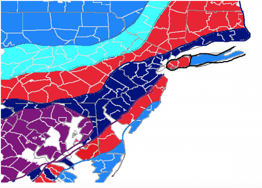
A weather map of New Jersey shows a lot of snow coming.
January 22, 2016
Good evening. I hope that everyone had a great day and is ready for this beast of a storm.
This is going to be one for the record books and I know that personally I am very excited. I expect the blizzard watch to go over to a blizzard warning either sometime late tonight or early tomorrow morning.
Timing and Facts:
Snow should begin to overspread the area between 10pm Friday-12am Saturday. Winds will be extremely strong with gusts up to 50 MPH. Thundersnow with 1-3 inch per hour snowfall rates is not out of the question.
SNOWFALL FORECAST:
Gray Area: Coating to 1
Green Area: 2-4 inches of snow (a lot of mixing)
Brown Area: 3-7 inches of snow (mixing)
Pink Area: 6-10 inches of snow
Orange Area: 7-12 inches of snow
Tan Area: 4-8 inches of snow
Light blue: 9-13+ inches of snow
Dark Blue: 12-20+ inches of snow
Purple: 18-24+ inches of snow
These numbers are subject to change. I truly believe that this storm has the potential to replace 1996 as the biggest snow storm ever to hit the Philly area; there is a 20-30% chance that happens.
As the storm goes on I will be posting videos and pictures form my location which is in Cherry Hill, New Jersey.
Stay safe we have the blizzard of 2016 on our hands. Thanks for reading have a great night.


